Find Megathrust Earthquakes in the USGS Catalog With JavaScript
A megathrust earthquake is a rupture of the fault between two converging plates at a subduction zone, where one plate dives beneath the other. The USGS subduction zone science page on earthquakes ties giant earthquakes to the stuck portions of that plate interface. The USGS earthquake catalog lets you check this in a few lines of code.
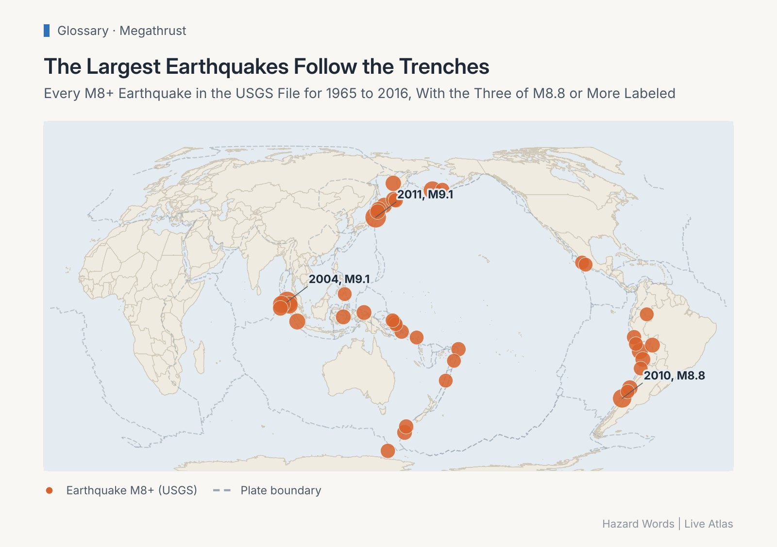
Nearly all magnitude 8 and larger earthquakes since 1965 struck at subduction zones (USGS catalog).
The Query
The USGS FDSN event web service is free, needs no key and answers in GeoJSON. Three parameters are enough here, a start date, a minimum magnitude and a sort order.
const params = new URLSearchParams({
  format: "geojson",
  starttime: "1965-01-01",
  minmagnitude: "8",
  orderby: "magnitude",
});

const res = await fetch(`https://earthquake.usgs.gov/fdsnws/event/1/query?${params}`);
if (!res.ok) throw new Error(`USGS API answered ${res.status}`);
const { features } = await res.json();

const quakes = features.map(({ properties, geometry }) => {
  const [lon, lat, depthKm] = geometry.coordinates;
  return {
    mag: properties.mag,
    place: properties.place,
    year: new Date(properties.time).getUTCFullYear(),
    lat, lon, depthKm,
  };
});

const shallow = quakes.filter(q => q.depthKm <= 70);
console.log(`${quakes.length} quakes of M8+ since 1965, ${shallow.length} of them 70 km deep or less`);

for (const q of quakes.slice(0, 5)) {
  console.log(`M${q.mag} ${q.year} ${q.place} (${q.depthKm} km)`);
}
for (const q of quakes.filter(q => q.depthKm > 70)) {
  console.log(`Deep exception: M${q.mag} ${q.year} ${q.place}, ${q.depthKm} km`);
}
Save it as megathrust.mjs and run node megathrust.mjs (Node 18 or later), or paste it into a browser console.
What It Prints
On November 6, 2026 the catalog returned 49 earthquakes of magnitude 8 or more since 1965, and 44 of them started 70 km deep or less. The top five are all shallow subduction ruptures, Sumatra 2004 and Tohoku 2011 at M9.1, then Kamchatka 2025 and Maule 2010 at M8.8, then the Rat Islands in 1965 at M8.7.
The five exceptions are deep, from 122 km under Peru to 645 km. They break inside the sinking slab, not on the plate contact, which is the other family of subduction zone quakes the USGS describes.
Why Shallow Matters
Megathrust ruptures sit close to the seafloor, so they can lift the ocean above them, which is why the largest ones set off tsunamis. The strongest on record, the M9.5 Valdivia earthquake of 1960, predates this query. Its depth was 33 km, as the Live Atlas record of the Valdivia earthquake shows. To see the shallow versus deep split for recent quakes, this depth explorer plots both, and the deadliest earthquakes table lists the human toll of the big ones.
About the author
- Exploring the planet through interactive maps, open insights, and visual storytelling.
Comments
Join the discussionNo comments yet. Be the first to comment.